Aqua-Analytica is a web application that aims to bridge the gap between data-rich environmental insights and actionable decision-making. By seamlessly integrating diverse datasets and employing cutting-edge analytical techniques, it empowers users across various fields to better comprehend and manage freshwater resources.
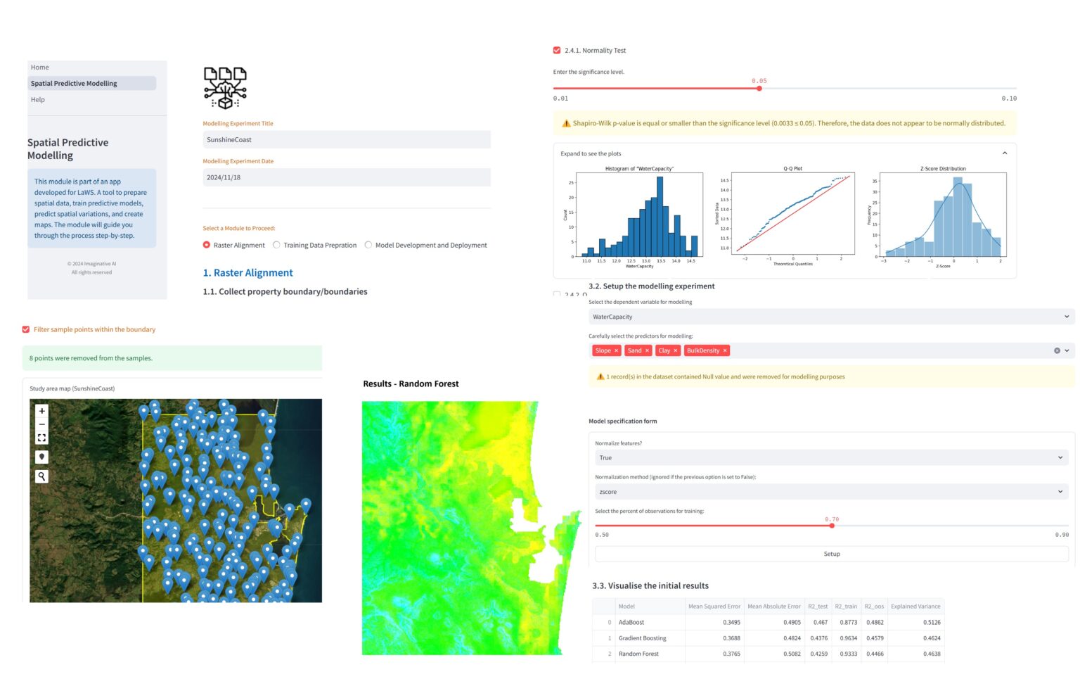
We developed a user-friendly web application that bridges the gap between machine learning and spatial analysis. By integrating advanced predictive modelling into an intuitive interface, our tool enables users to perform complex geospatial tasks without requiring deep technical expertise. It simplifies the modelling pipeline and makes spatial analytics more accessible to consultants, researchers, and decision-makers alike.
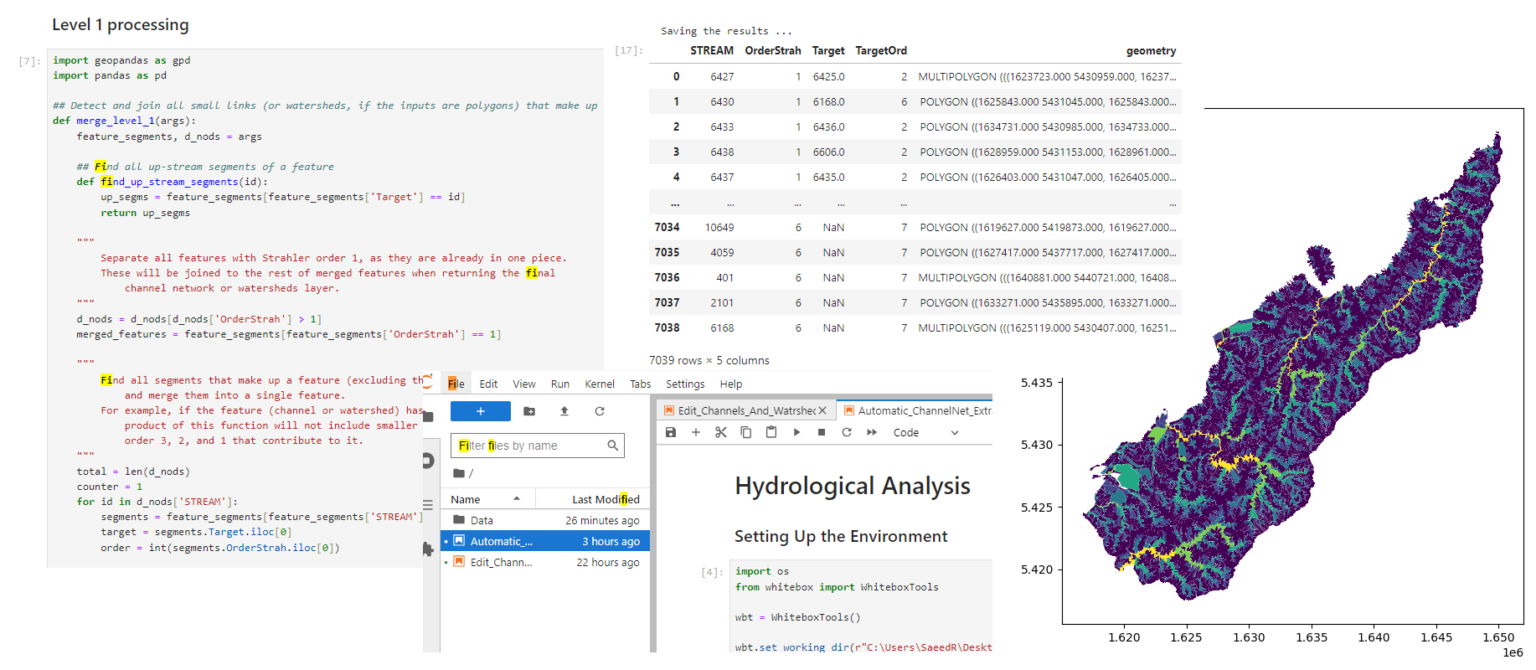
Watershed Delineation Automation
Streamlined and semi-automated watershed delineation using advanced geospatial analysis, high-resolution satellite imagery, and LiDAR-derived elevation models. The solution significantly accelerated hydrological assessments while maintaining precision, making complex spatial analysis faster, smarter, and more accessible.
Sediment Delivery Risk Assessment
Collaborated with Land and Water Science Ltd on LiDAR-based hydrological analyses across New Zealand, delivering insights to support evidence-based environmental conservation and land management decisions.
Talk to us
We’re here to discuss your business, explore new projects, uncover creative opportunities, and find ways we can support you.